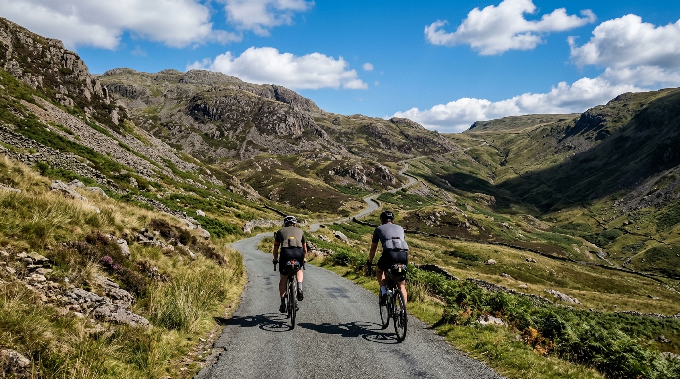
Walney to Wear and Whitby Cycle Route
A 315 km asphalt point-to-point route with 2101 m of climbing and a concentrated list of major passes to manage.
- Distanz
- 315km
- Höhenmeter
- 2,101m
- Untergrund
- —
- Form
- Punkt-zu-Punkt
Die Route
Höhenprofil
Route character
The Walney to Wear and Whitby Cycle Route is a long asphalt point-to-point ride in GB, covering 315 km with 2101 m of elevation gain. That combination gives the route its defining tension: the distance is the main load, but the climbing is too important to treat as background noise.
This is not a loop, so logistics matter before fitness does. Transport, accommodation, resupply, and how you get back from the finish need to be sorted in advance. A point-to-point route rewards commitment, but it gives fewer easy exits than a local circuit.
Terrain and climbing pattern
The listed climbs tell the real story. Wrynose Pass, Kirkstone Pass, Hardknott Pass, Honister Pass, Dunmail Raise, Buttertubs Pass, Sty Head, and Killhope Cross are not random lumps on a rolling route. They are the points where pacing discipline becomes decisive.
With 2101 m of elevation gain across 315 km, the climbing is not defined by constant vertical pressure. Instead, expect the ride to alternate between longer linking sections and sharper terrain features that can do disproportionate damage if ridden too hard. That is the key tactical point: the route is long enough that early overreaching on the named climbs will keep charging interest later.
The asphalt surface makes bike choice straightforward. This is a road-focused route rather than a mixed-surface gamble, so the bigger question is not tyre survival on rough tracks, but comfort, gearing, and whether your position still feels efficient after several hours.
How to pace it
Treat the route as an endurance ride with climbing interruptions, not as a sequence of hill efforts. The most common mistake on a route like this is to ride each famous climb according to reputation, then discover that the 315 km distance has the final say.
If you pace by power, keep the climbs capped relative to your /glossary/ftp rather than chasing speed over the top. If you pace by feel, the rule is simple: the first half should feel almost too controlled. The route gives plenty of opportunities to spend energy, and very few reasons to spend it early.
Practical notes
- Plan it as a point-to-point ride, not a self-contained loop.
- Build your food and water plan around the full 315 km distance, not just the climbs.
- Use gearing that lets you ride the named passes without repeated high-torque surges.
- Expect the asphalt surface to favour a road setup, but prioritise comfort over pure speed.
- Keep something in reserve for the later climbing features, especially if you have already ridden Wrynose Pass, Kirkstone Pass, Hardknott Pass, Honister Pass, or Dunmail Raise earlier in the day.
The route’s challenge is not any single statistic in isolation. It is the way 315 km, 2101 m of elevation gain, asphalt roads, and a non-loop format combine. Ride it like a long endurance problem with several serious decision points, and it becomes manageable. Ride it like a collection of isolated climbs, and the distance will expose that mistake.
Anstiege auf dieser Route
Hardknott Pass
Kat. 2England's steepest road - 2.4 km from Eskdale at 13 percent average, with 30 percent ramps on the upper switchbacks.
Wrynose Pass
Kat. 3Wrynose Pass is a 10.6 km Lake District climb with a deceptive 3.1% average gradient that hides a savage 18.48% maximum. Here's how the road actually unfolds.
Buttertubs Pass
Kat. 3A 6.3 km Category 3 climb through the Yorkshire Dales, Buttertubs Pass averages 4.16% with sharp ramps to 13.11% — deceptively varied and worth understanding before you ride it.
Whinlatter Pass
Kat. 4A short category 4 climb in Great Britain where 125m of hidden re-climbing turns a modest 3.92% average into a punchier effort than the numbers suggest.
Killhope Cross
Kat. 3A 7.2km Category 3 climb in Great Britain with a modest 3.86% average that hides steep ramps and 113m of hidden climbing from undulation.
Dunmail Raise
Kat. 4A compact Lake District climb: 2.8 km at 5.08%, with enough gradient to reward steady pacing over a hard early surge.
Sty Head
Kat. 2A practical profile of the Sty Head cycling climb: 6.8 km at 6.69%, with a severe 23.06% maximum gradient shaping pacing and gearing.
Kirkstone Pass
Kat. 3Kirkstone Pass is a 6.9 km Lake District climb with 324 m of net elevation gain, an average gradient of 4.67%, and a punishing 17.24% maximum. Here's how to ride it smart.
Honister Pass
Kat. 3Honister Pass is a 7.1 km Lake District climb with a deceptive average gradient of 3.97% that masks a brutal 19.67% maximum ramp. Here's how to pace and gear it.
Hardknott Pass
Kat. 3A practical pacing guide to Hardknott Pass, a 4.2 km category 3 climb with a 4.94% average gradient and sharper ramps up to 13.36%.
Ähnliche Routen
3-Länder-Radweg
A 302.2 km asphalt route in Germany with 1512 m of climbing and point-to-point logistics shaped by the Reußenkreuz climb.
7 Peaks Alpine Challenge
A 110.9 km point-to-point assault through the Victorian Alps, stacking 3404 metres of climbing across relentless, wind-swept high-country ascents.
Aberdare Range
A 46 km asphalt point-to-point through Kenya's Central Highlands that trades big climbs for a relentless 1,700 m of rolling grind.
Abra Málaga
A 45-kilometer point-to-point ribbon of asphalt through Peru's Sacred Valley, climbing 1,699 relentless meters into the high Andes.
Afriski Mahlasela Pass
A 112.8 km asphalt ascent through the Maloti Mountains, climbing 3,384 m to the roof of southern Africa via the storied Mahlasela Pass.
Ahr Cycleway
An 82.9 km asphalt point-to-point route with 541 m of gain, the Ahr Cycleway is a steady endurance ride rather than a climb-focused day.