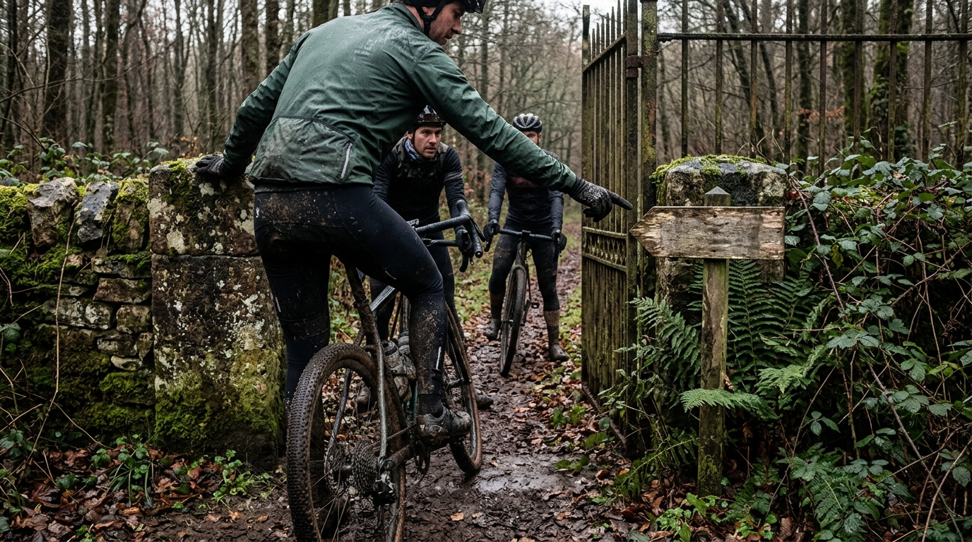
Image generated by our model.
route planning
Cycling Route Legality: Plan Legal Rides That Work
A practical workflow for checking cycling route legality across roads, trails, private land, closures and group rides before you share the file.
Legality is part of route quality
Cycling route legality is not a compliance box to tick after the fun planning is done. It is part of the route quality itself.
A route can have the right distance, the right climbing, the right surface and the right cafe stop, but if it crosses private land, uses a foot-only path, enters a closed trail system or sends a group into an access conflict, the route is not good. It is fragile.
For data-driven endurance athletes, that matters because the route is the environment that determines whether the planned work can happen. Stops at gates break steady endurance work. Forced reroutes create fueling and timing risk. Crowded or inappropriate paths ruin interval repeatability. Group confusion at a restricted access point increases safety risk because riders start making decisions under pressure.
The strongest routes are not just scenic or hard. They are executable. Access is settled before the ride starts, so pacing, fueling, handling and training specificity can stay in focus.
Jurisdiction disclaimer
Access rules vary by country, state, county, municipality, land manager and trail authority. Roads, paths, bridleways, byways, footpaths, public rights of way, private roads, forest tracks and trail systems are not governed by one universal framework.
Terms such as 'bridleway', 'byway', 'footpath' and 'public right of way' are examples from certain jurisdictions, not global categories. In other places, the same physical-looking path may be governed by municipal code, park rules, forest service policy, private easement, trail authority designation or landowner permission.
This article is a verification workflow, not legal advice. Use it to decide what to check, how to document uncertainty and when to reroute. If access is material, disputed or high-consequence, confirm it with the relevant authority before riding or sharing the file.
The route planner shows connectivity, not permission
The common planning mistake is treating every visible line on a map as equal. A digital map can show that two places connect. It cannot always prove that bicycles are allowed there today.
That distinction changes how a good route is built. The route planner is useful for spotting roads, tracks, paths, gates, barriers, surface hints and access tags. It is not the final authority when a segment leaves the normal public road network or passes through land with special rules.
The higher the consequence of a segment, the more verification it deserves. A questionable scenic spur can be deleted. A questionable connector that holds the entire loop together needs authoritative confirmation or a legal replacement.
Where access problems usually enter a cycling route
Public roads
Public roads are usually the cleanest starting point, but they are not automatic. Some roads restrict bicycle access because of controlled-access rules, traffic design, tunnels, bridges, construction zones or local regulations.
If a road classification looks questionable, verify it before building the route around it. This is especially important when the road is the only safe connector between two otherwise good sectors. If that connector fails, the route can collapse into a bad reroute at the worst moment.
Bike lanes, cycle tracks and shared-use paths
Bike lanes and cycle tracks can improve both legality and ride quality, but they still have rules. Some are directional. Some are shared with pedestrians. Some are governed by traffic controls. Some are designed for low-speed local movement rather than fast group riding.
The legal question comes first: are bikes permitted? The performance question follows: can the facility support the ride you are planning?
A recovery ride, commute-style link or social spin can fit well on a shared path. A structured paceline or threshold workout usually needs a more predictable environment. If the route constantly forces braking, coasting, passing or conflict management, it may be legal but still wrong for the session.
Paths, rights of way and named access categories
This is where riders often get caught out because surface quality and legal access do not always match.
In some jurisdictions, categories such as bridleways, byways, footpaths or public rights of way carry specific meanings. Elsewhere, similar-looking corridors may be park paths, easements, private tracks, forest roads, utility roads, farm access roads, towpaths, campus roads or trail-authority routes.
Never infer bicycle access from how rideable the surface looks. A smooth path can be foot-only. A rough track can be legal. A gravel road can be private. A trail can allow bikes in one direction but not the other.
For off-road planning, the access layer is as important as the terrain layer.
Trails and singletrack
Trail access is often more dynamic than road access. A system may have direction rules, wet-weather closures, seasonal restrictions, construction closures, wildlife protections, user-specific designations or event-day changes.
This is why imported files need skepticism. A shared route may reflect local knowledge, an event permit, a past access arrangement, an outdated map layer or a simple mistake. Treat imported files as suggestions, not proof.
A concrete verification workflow
Use the same sequence every time a route leaves straightforward public roads. The goal is not to make planning slower. It is to catch the segments most likely to fail before they compromise the ride.
1. Identify every non-road segment
Scan the full route and mark every section that is not an ordinary public road: paths, trails, service roads, farm tracks, estate roads, towpaths, campuses, parks, forest roads, utility corridors and short cut-throughs.
Short connectors deserve extra attention because they often look harmless in the planner but carry the most access ambiguity on the ground.
2. Check the route planner access information
Look at access tags, way type, surface notes, barriers, gates and user labels. If the planner marks a section as private, foot-only, restricted, unknown or unclear, treat it as unresolved.
Also flag segments that appear in one map layer but not another, or that avoid a road junction too neatly. Those are classic signs of a route file optimizing for shape rather than permission.
3. Cross-check against authoritative sources
For uncertain segments, check the most relevant official or semi-official source available. Depending on the place, that may include:
- Local road authority pages
- Official municipal or county maps
- Public rights-of-way maps where available
- Park, forest service or land-manager access pages
- Official park or trail closure pages
- Trail association status pages
- Land-manager notices at trailheads or online
- Event permits or organizer route notes when access is event-specific
- Current on-site signage
Do not overread any single source. The point is to build enough confidence that bicycle access is allowed for the date, user type and ride format you are planning.
4. Check recent closure notices
A route that is normally legal can still be wrong on the day. Look for maintenance closures, storm damage, construction, forestry work, wildlife restrictions, wet-weather rules and public events.
Closures are not obstacles to improvise around mid-ride. They are route design inputs. If a trail system or park corridor is closure-prone, build the legal alternative before the file is shared.
5. Mark questionable sections
Do not leave uncertainty buried in the route file. Mark questionable sectors while planning so they are either resolved or removed before the ride.
A useful note is specific: 'access unconfirmed at forest connector', 'check park closure page before ride', or 'private road unless event permit applies'. Vague confidence is not useful when a group reaches a gate.
6. Build a legal reroute
Every access-sensitive route should have a clean alternative for the sections most likely to fail. The reroute must be legal, not merely convenient.
This matters for training quality. A rider who has to improvise a detour late in a long endurance ride risks extra time, missed fueling, unsuitable roads and unnecessary stress. A leader who already has a legal bailout keeps the group moving and reduces bad decision-making.
7. Save notes before sharing
Before publishing or sending the file, put access notes in the route description. Mention surfaces, restricted or sensitive sectors, closure checks, permitted-use assumptions and legal bailout points.
A route without notes invites riders to assume everything is straightforward. If the access is conditional, seasonal, event-specific or uncertain, the file should say so.
How to treat signs on the ground
Signs matter, but the cleanest rule is not that every sign is always legally perfect. Unofficial private signs, outdated notices and statutory maps can conflict. The practical rule is stricter and safer:
Treat restrictive signs as a stop-and-verify trigger, and do not ride past them unless you have authoritative confirmation that cycling access is permitted.
If a sign says no bicycles, private, closed, foot traffic only or authorized users only, the route file does not outrank it in the moment. Stop, verify or reroute.
This is especially important with groups. A solo rider can turn around quietly. A group arriving at a restricted access point creates social pressure, blocks space and makes poor decisions more likely. The leader should not be discovering the access problem at the gate.
The decision rule for ambiguous segments
Ambiguity has a cost. It may not show up in the distance or elevation profile, but it appears in execution.
Use this rule: if a segment is short, non-essential, unsigned, absent from official maps, marked private, marked foot-only, marked restricted in any source or unclear after checking, remove it unless explicit bicycle access can be confirmed.
That may feel conservative, but it is usually the better route-building decision. A short questionable connector rarely adds enough training value to justify the risk it introduces. If it is essential, it needs confirmation. If it is not essential, it should not decide the route.
Private land and conditional access
Private land is where map-based planning creates the most false confidence. A visible track is not proof of public access. A farm road, driveway, estate road, logging road, utility corridor or service road can look exactly like a legitimate gravel connector in a planner.
The question is not whether a bike can pass. The question is whether access is granted.
Permission can be explicit, conditional, informal or prohibited. Conditional and informal access need special care. A landowner may tolerate local individual passage but not want organized groups. A trail may allow bikes only in certain conditions. A property may permit access on one signed corridor but not on side tracks.
This is where legality and long-term cycling access meet. A single route file can send many riders through the same sensitive place. If that file depends on tolerated or unclear access, it can damage the relationship that made the passage possible in the first place.
Keep the training purpose intact
Legal verification should sharpen the route, not make it bland. The best process is to judge access decisions against the purpose of the ride.
If the ride is endurance-focused, prioritize continuity. A slightly less scenic legal road with predictable flow often beats a prettier route stitched together by stop-start paths and uncertain connectors.
If the ride is gravel-focused, prioritize confirmed access over novelty. A legal loop with fewer surprises is better than an adventurous file that depends on a private gate being open.
If the ride includes intensity, be strict. Intervals need terrain that allows consistent power, safe sight lines and low conflict with other users. Use FTP-based targets only on roads or climbs where the effort can actually be executed.
A practical route hierarchy works well:
- Define the training purpose: endurance, climbing, tempo, skills, recovery or social
- Build the legal skeleton: permitted roads, approved paths, confirmed trails and verified connectors
- Add ride quality: surface, profile, traffic exposure, wind exposure and resupply
- Remove ambiguity: private tracks, unsigned cut-throughs, uncertain access and closure-prone sectors
- Add legal bailouts that preserve the ride if conditions change
That order matters. If legality is left until the end, it becomes a threat to the route. If it is built in early, it becomes part of the design.
Group rides need a higher standard
Sharing a route raises the standard because other riders will treat the file as vetted. Leading a group raises it again because access problems become safety problems faster.
A narrow shared path might be fine for one rider at a quiet time and a poor choice for a group at peak use. A trail where individual cyclists are tolerated may become a problem when a large group arrives together. Legal permission and social permission are not identical, but both shape whether cyclists remain welcome.
Group leaders should make access decisions before the ride, not at the pinch point:
- Avoid narrow shared paths at peak times when the group cannot pass without conflict
- Avoid access-sensitive trails if the group size will make low-impact riding unrealistic
- Disclose surfaces, trail sectors, shared-use paths and access-sensitive sections in the ride notes
- Name legal bailout points before the ride starts
- Pre-assign regroup points that do not block gates, drives, road junctions, trailheads or narrow paths
- Identify any sections that require single-file riding, reduced speed or extra spacing
- State whether the route is suitable for the planned bike type and tires
- Explain whether riders must stay on the file to remain on permitted access
If a route depends on an event permit, club permission, land-manager agreement or private arrangement, say so clearly. Riders should not assume the route is generally open if access only applies under specific conditions.
Pre-ride legality checklist
Use this checklist before finalizing a route, especially when it includes trails, paths, private land, unfamiliar connectors or group access.
Route file check
- Have you identified every non-road segment?
- Does every path, trail or track have confirmed bicycle access?
- Are any sections marked private, foot-only, restricted or unclear?
- Does the route use farm tracks, estate roads, service roads, utility corridors, campus roads or forest roads?
- Are gates, barriers or signs visible in map imagery that need verification?
- Does the route rely on a short connector that looks too convenient?
Official access check
- Have you checked the relevant road authority, municipality, land manager, park page, trail authority or access map?
- Have you checked closure pages or trail status updates?
- Are there weather, maintenance, wildlife, construction or event restrictions?
- If private land is involved, is permission explicit and current?
- If an event permit is required, does the route note that access is permit-specific?
Ride-quality check
- Is the legal route still appropriate for the training goal?
- Are shared-use sections compatible with the planned pace and group size?
- Are interval sections free from avoidable access, stopping or user-conflict problems?
- Are resupply and fueling assumptions still valid if a legal reroute is needed?
- Are bailout options legal rather than just convenient?
Sharing and group check
- Would another rider understand which sectors are roads, paths, trails or access-sensitive corridors?
- Have ambiguous shortcuts been removed before publishing the file?
- Are legal bailout points named in the notes?
- Are regroup points placed away from gates, drives, trailheads and junctions?
- Is the route legal for the intended users, bikes and ride format, not just for one local rider?
The bottom line
A legal route is not necessarily a conservative route. It is a route that can be executed.
That is the decisive planning standard. If a segment compromises access, creates uncertainty or puts the session at risk, it has to justify itself. Most questionable shortcuts do not. Confirm them, replace them or delete them.
Speed, distance, climbing and scenery still matter. They just come after the route is allowed, open and appropriate for the ride you are actually trying to do.