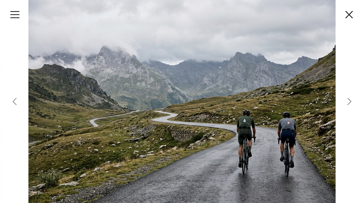
Quebrantahuesos
A 196.3 km Pyrenean loop stacking 5,148 m of climbing across the Somport, Aubisque, and Marie-Blanque.
- Distance
- 196.3km
- Climbing
- 5,148m
- Surface
- Asphalt
- Shape
- Loop
The route
Elevation profile
Overview
The Quebrantahuesos is one of cycling's great mountain endurance challenges, a 196.3 km loop through the Aragonese Pyrenees that begins and ends in the same place. Its name, the Spanish word for the bearded vulture that soars over these peaks, suits a route that lives in high, thin air. Over its full distance it accumulates 5,148 m of climbing, a figure that places it firmly among the most demanding single-day rides in Europe. This is not a course you drift around; it is a course you survive, one pass at a time, until the loop finally closes back on itself.
The Route
The genius of the Quebrantahuesos lies in its shape. As a closed loop, it carries riders out from the start into the heart of the mountains and then draws them back, so that every metre of the 196.3 km eventually returns to where it began. The route straddles the Pyrenean spine, crossing between Spain and France as it links its marquee climbs together. Long valley approaches stretch out between the ascents, giving the legs brief reprieve before the road tilts skyward again. There is no hiding in the middle of this loop: the 5,148 m of vertical gain is distributed across a handful of serious mountain passes, and the terrain never truly flattens for long.
Key Climbs
Four climbs define the character of the Quebrantahuesos. The Somport carries the route across the frontier ridge of the Pyrenees, a long, storied pass that has funnelled travellers between Spain and France for centuries. On the French side, the Col de Marie-Blanque delivers a short but famously punishing wall, the kind of climb where the road rears up and rhythm goes out the window. From there the route reaches for the Col d'Aubisque, a giant of Pyrenean cycling whose exposed upper slopes open onto vast mountain panoramas. Finally the Puerto de Astún completes the high-mountain quartet, a climb toward the ski terrain that helps push the day's total toward its full 5,148 m. Together these four passes form the backbone of the loop, and each one asks a different question of the rider.
Terrain & Surface
The entire Quebrantahuesos is ridden on asphalt, from the valley floors to the summits of its highest passes. That paved surface means the challenge here is purely one of gravity and distance rather than of loose or broken ground. On the long climbs the smooth road lets riders settle into a steady, grinding cadence, while the descents off the high cols reward confident, flowing handling. With no gravel or cobbles to contend with, the Quebrantahuesos is a test of climbing legs and pacing discipline across its full 196.3 km.
When to Ride
This is a high-mountain route, and the passes it crosses sit well above the tree line. The warmer months are the natural window, when the cols are clear and the long daylight hours give ample time to complete nearly 200 km. Even then, weather in the Pyrenees can turn quickly at altitude, so riders should carry layers for exposed summits like the Aubisque and Astún, where conditions on the climb can differ sharply from the valleys below.
Logistics
Because the Quebrantahuesos is a loop, logistics are refreshingly simple: start and finish are the same, so there is no need to arrange transport between two points or shuttle a vehicle. Riders can leave from the trailhead and return to it under their own power. Given the 5,148 m of climbing and the 196.3 km distance, planning should centre on fuelling and hydration across the long stretches between passes, with resupply timed around the valley sections that separate the major climbs.
Summary
The Quebrantahuesos earns its iconic status through sheer scale: 196.3 km, 5,148 m of climbing, and a chain of legendary Pyrenean passes ridden entirely on asphalt. Crossing the Somport, Marie-Blanque, Aubisque, and Astún in a single loop, it distils everything that makes mountain cycling extraordinary into one unforgettable day in the saddle.
Climbs on this route
Collado de Izas
Cat 1A 24.8 km category 1 grind averaging 5.59% that hauls you from 847 m to 2234 m, with ramps spiking to 21.71%.
Puerto de Escalé
Cat 1A Category 1 haul: 19.8 km at 5.49% average, climbing from 587 m to 1672 m with a brutal 20.75% max ramp.
Collado La Magdalena
Cat 1A 22.5 km Category 1 climb in Spain with a deceptive 4.69% average, a 19.84% ramp, and over 1,000 m of hidden re-climbing.
Puerto de Astún
Cat 114.1 km at 6.16%, climbing from 841 m to 1707 m — a sustained Cat-1 grind with pitches touching 10.79%.
Col d'Arrémoulit
HCEleven kilometres at a brutal 10.62% average, hauling you from 1279 m to 2451 m — an HC monster with 1172 m of net gain.
Col de Bessata
Cat 2A 12 km category 2 climb rising 543 m at a steady 4.51% average, with a fierce 15.88% pinch waiting somewhere in the mix.
Collado de Array
Cat 3A 15.6 km grind at 3.06% average that gains 478 m to a 1194 m summit, with pitches spiking to 10.98%.
Alto de San Quílez
Cat 2Just 2.9 km long but averaging a brutal 8.94%, San Quílez climbs 263 m to a 1113 m summit with pitches touching 12.09%.
Col des Moines
HC18.8 km at 7.25% climbing from 815 m to 2175 m — a 1360 m HC haul that never lets up.
Col d'Aubisque
HC18.4 km at 6.76% average, ramping to 12.37%, hauling you from 467 m to a 1711 m summit — a full HC test.
Somport
HCA 23.3 km hors catégorie grind averaging 6.11%, hauling you 1424 m up to a 2243 m summit with pitches spiking to 16.69%.
Col de Marie-Blanque
Cat 2A deceptive Pyrenean Cat 2 climb: 24.6 km of gentle approach gives way to brutal ramps hitting 21.65% near the summit. Here's how the gradient unfolds and how to pace it.
Col d'Arriel
HC31.2 km of relentless climbing at 5.22% average to 2259 m, with pitches spiking to 17.7% — a true HC test.
Col de Sobe
HCA 29.5 km HC monster climbing from 676 m to 2248 m, 1572 m of net gain at 5.33% average with ramps hitting 18.37%.
Collado Este de Orná
HCA 25.5 km hors catégorie monster climbing 1457 m at 5.71% average, with a brutal 20.95% spike to a 1977 m summit.