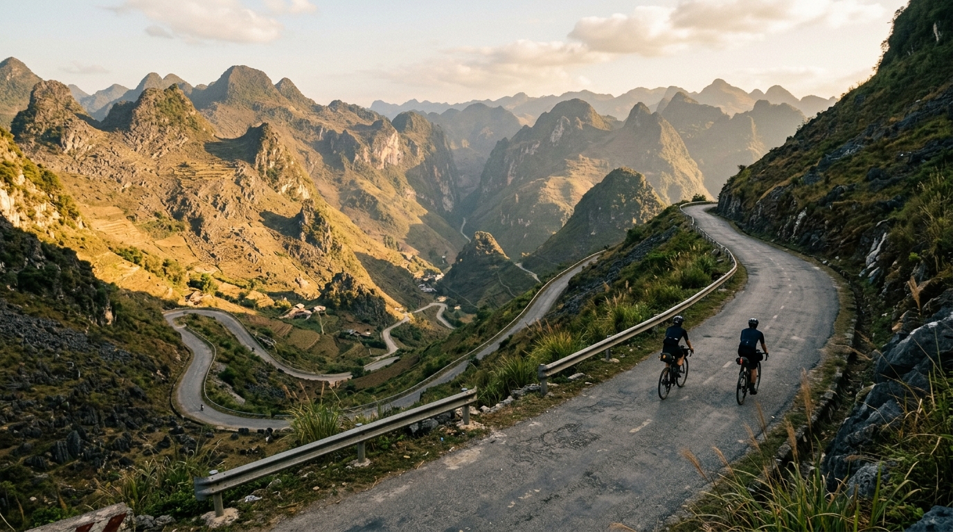
Ha Giang Loop
A 136-kilometer point-to-point ribbon of asphalt through Vietnam's far north, stacking 5,175 meters of relentless mountain climbing.
- Distance
- 136.4km
- Climbing
- 5,175m
- Surface
- Asphalt
- Shape
- Point-to-point
The route
Elevation profile
Overview
The Ha Giang Loop is one of Southeast Asia's most storied road-cycling routes, a 136.4-kilometer point-to-point journey through the mountainous far north of Vietnam. Threading the highlands of Ha Giang province near the Chinese border, it has become a bucket-list ride for cyclists drawn to raw vertical terrain and constantly shifting scenery. Over its length the route accumulates 5,175 meters of total climbing — an enormous elevation figure for the distance, averaging out to a route that almost never lets you settle into flat, easy pedaling. It is a ride defined less by any single landmark than by its sheer, sustained verticality across surfaced mountain roads.
The Route
As a point-to-point route rather than a closed circuit, the Ha Giang Loop carries riders steadily through the region rather than returning them to their starting line. Across 136.4 kilometers, the road threads a landscape of near-continuous elevation change, banking the vast majority of its 5,175 meters of climbing into a chain of ascents and descents that follow the contours of the terrain. There is little in the way of respite: the profile trends upward almost as a matter of course, and the descents that follow each rise demand as much focus as the climbs that earn them. It is a route to be ridden with pacing and patience, where conserving energy over the first half is what makes the second half possible.
Key Climbs
This route has no individually catalogued climbs, and that absence is itself telling. Rather than being organized around a handful of famous, named passes, the Ha Giang Loop's difficulty is distributed across its entire length. The defining feature here is cumulative vertical gain — 5,175 meters of it spread over 136.4 kilometers — delivered as a continuous sequence of rolling and mountainous grades rather than one or two marquee ascents. The challenge is one of relentless accumulation: the climbing never truly stops, and the total is built meter by meter across the whole point-to-point crossing rather than concentrated in any single celebrated wall.
Terrain & Surface
The Ha Giang Loop is ridden entirely on asphalt, which shapes the character of the day considerably. A sealed surface means the route rewards road bikes and rolling efficiency, letting riders carry momentum through the descents and settle into a rhythm on the sustained climbs without contending with loose gravel or broken track. The paved road keeps the emphasis squarely on the terrain's vertical demands — the 5,175 meters of climbing — rather than on surface hazards. It is a genuine mountain road experience delivered on tarmac, which makes the enormous elevation figure all the more the defining test of the ride.
When to Ride
Because the Ha Giang Loop climbs so much over its 136.4 kilometers, choosing a day with settled, dry conditions is worth the effort. Cooler, clear weather makes the sustained ascents more manageable and keeps the asphalt descents predictable underwheel. Aim for daylight hours that give you a comfortable margin to complete the full point-to-point distance without racing the clock, since 5,175 meters of accumulated climbing will always take longer than the flat-equivalent distance suggests.
Logistics
The point-to-point format is the single most important logistical consideration for the Ha Giang Loop. Because the ride finishes in a different place from where it begins, you will need to plan how to return to your start, arrange onward transport, or organize a shuttle or support vehicle in advance. Carry enough food and water to stay fueled across the climbing, and prepare for the long, sustained effort that 5,175 meters of ascent over 136.4 kilometers represents. On asphalt, a well-geared road bike with reliable brakes for the descents is the natural choice.
Summary
The Ha Giang Loop earns its iconic status through sheer scale: 136.4 kilometers, 5,175 meters of climbing, and a paved surface that keeps the focus on the mountains themselves. With no single defining climb, its difficulty lives in the relentless, cumulative vertical of a true point-to-point crossing through the highlands of Ha Giang, Vietnam — a ride that asks for patience, pacing, and respect for every meter it gains.