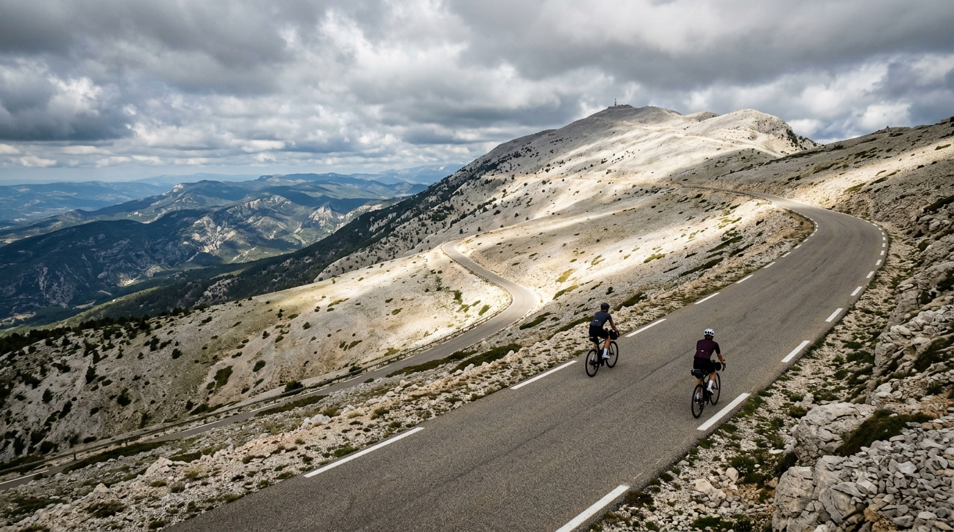
Mont Ventoux from Bédoin
A relentless 25.4 km climb out of Bédoin to the wind-scoured summit of Mont Ventoux, packing 1616 m of ascent into one unbroken effort.
- Distance
- 25.4km
- Climbing
- 1,616m
- Surface
- Asphalt
- Shape
- Point-to-point
The route
Elevation profile
Overview
Few rides in cycling carry the mythology of Mont Ventoux from Bédoin. This 25.4 km point-to-point route strings together everything that makes the mountain famous: a long, uninterrupted haul out of the Provençal foothills to the exposed, pale summit that dominates the horizon for miles. In total, the climb gains 1616 m of elevation, a staggering figure for a route of this length and the reason the ascent has become a benchmark against which riders measure themselves. There is no easing in, no false summit that lets you off the hook — just Bédoin below and the observatory tower above. For many cyclists, completing this climb is the singular goal of a trip to Provence, and the route delivers a pure, concentrated challenge from the first pedal stroke to the last.
The Route
The line is simple to describe and brutal to execute: it runs point-to-point from the village of Bédoin up to the top of Mont Ventoux, covering 25.4 km. What the numbers hide is the shape of the effort. With 1616 m of climbing packed into that distance, the road spends almost its entire length pointing upward, and the ascent is sustained rather than punctuated by recovery. Riders leave the warmth and greenery around Bédoin, work through the forested middle section that shelters the road, and then break out into the open on the mountain's upper flanks, where the landscape turns stark and lunar. The final stretch to the summit is fully exposed, and the tower at the top stays in view long before you reach it — a psychological test as much as a physical one.
Key Climbs
This route is defined by a single, legendary ascent: Mont Ventoux itself. Rather than passing several named climbs, the entire 25.4 km is the climb — one continuous effort that accumulates 1616 m of vertical gain. That singularity is precisely what gives the route its reputation. There is no shared workload across multiple passes; every meter of ascent belongs to the same mountain. The lower and middle sections through the trees demand steady, patient pacing, while the barren summit approach exposes riders to whatever the mountain's notorious winds are doing that day. Conquering Mont Ventoux from Bédoin means holding an honest tempo for the full distance, because the mountain rarely relents long enough to let you recover.
Terrain & Surface
The entire route is asphalt, giving riders a consistent, predictable road surface from Bédoin to the summit. That paved surface means the challenge is almost entirely about gradient and endurance rather than rough terrain or technical handling — there is no gravel or broken ground to negotiate, so your attention stays on cadence, pacing, and the accumulating altitude. The tarmac carries you through the sheltered forest and out onto the open upper slopes, where the character of the ride changes dramatically even though the surface beneath your tires does not. On the fast, exposed descent that the summit rewards you with, that same smooth asphalt allows confident, controlled speed.
When to Ride
Mont Ventoux is a summit ride, and the exposed upper section shapes the best time to attempt it. The barren, treeless terrain near the top offers no protection, so a calm, clear day makes an enormous difference to both safety and enjoyment. The wind that gives the mountain its name can be fierce on the summit approach, so choose settled weather and start early to make the most of stable morning conditions. Warmer months, when the road to the top is open and free of snow, are the natural window for this climb.
Logistics
As a point-to-point route, this climb begins in the village of Bédoin, a natural staging post at the foot of the mountain and a sensible place to prepare, fuel, and set off. Because the route finishes 25.4 km away and 1616 m higher at the summit of Mont Ventoux, plan your return in advance — most riders descend the same or an alternate paved road back down. Carry enough food and water for a sustained effort, dress for the sharp temperature drop and wind at the exposed top, and pace the lower slopes conservatively to leave something for the open final kilometers.
Summary
Mont Ventoux from Bédoin is cycling's climb in its purest form: 25.4 km, 1616 m of ascent, all on asphalt, all uphill, all on one unforgettable mountain. It rewards patience, respect for the wind, and the determination to keep turning the pedals until the summit tower is finally beneath you.