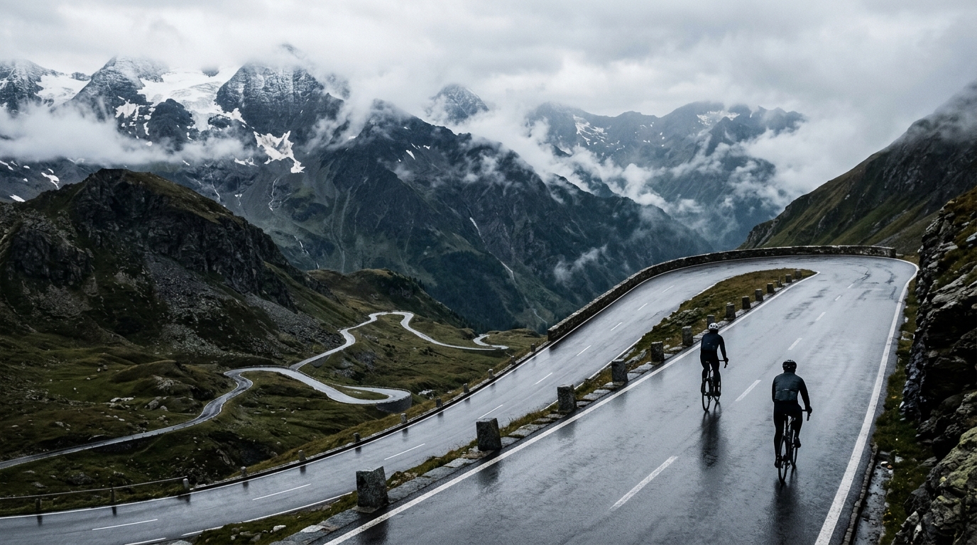
Grossglockner High Alpine Road
A 46.1 km point-to-point pilgrimage across the High Tauern, stacking 2087 m of climbing on flawless asphalt over the legendary Hochtor.
- Distance
- 46.1km
- Climbing
- 2,087m
- Surface
- Asphalt
- Shape
- Point-to-point
The route
Elevation profile
Overview
The Grossglockner High Alpine Road is one of the most revered stretches of tarmac in the Alps, a 46.1 km point-to-point ascent through the heart of the High Tauern in Austria. Over its length it accumulates 2087 m of climbing, a figure that places it firmly among the great high-mountain challenges a cyclist can attempt in a single push. This is not a rolling countryside spin; it is a sustained journey upward, a route that trades gentle preambles for the raw, uninterrupted work of gaining altitude against the flank of Austria's most storied massif.
What makes the road iconic is the totality of the experience. It carries riders out of valley air and into the thin, bright atmosphere of the high mountains, past the point where trees give way to rock and open sky. The 2087 m of vertical gain is not padding — it is the reason people come. Few routes deliver so complete a sense of transition, from the base to the roof of the region, in a compact 46.1 km.
The Route
As a point-to-point route, the Grossglockner High Alpine Road commits you from the moment you begin. There is no loop to soften the return, no flat middle section to recover the legs — the road exists to climb, and it does so relentlessly across its 46.1 km. Riders should plan logistics around the two distinct endpoints rather than a single trailhead, since the profile does not return you to where you started.
The route threads through the High Tauern, the mountain landscape that gives the road its grandeur. Every kilometre earns its share of the 2087 m total, and the effort is distributed across a course designed to carry you steadily and dramatically higher. The reward is the scenery that unfolds as you gain elevation: an ever-widening panorama of alpine terrain that grows more austere and more spectacular the higher you push.
Key Climbs
The defining high point of the route is the Hochtor, the pass that anchors the road's reputation and represents the crux of the day's climbing. Reaching the Hochtor is the moment the route's 2087 m of accumulated ascent pays off — it is the natural summit of the effort, the place where the sustained work of the lower and middle sections finally crests. Everything on the way up builds toward it, and cyclists tend to measure their day by whether the Hochtor is behind them or still ahead. As the marquee climb of the route, it is the feature that gives the Grossglockner High Alpine Road its enduring place in the imagination of alpine cyclists.
Terrain & Surface
The entire route is paved in asphalt, and that surface is a meaningful part of its appeal. Smooth tarmac means the challenge is honest: the difficulty comes from gravity and distance, not from loose or broken ground. Riders can run standard road tyres with confidence, focus on rhythm and pacing, and trust the surface through the descents as well as the climbs. The asphalt makes the 2087 m of climbing a pure test of fitness and endurance rather than a technical, surface-dependent gamble. It also means the route rewards a well-set-up road bike and clean, efficient climbing form over the full 46.1 km.
When to Ride
High-alpine routes like this one are best attempted in the warmer months, when the upper reaches are clear and conditions on the exposed sections are at their most forgiving. Because the road climbs so high — the price of that 2087 m of ascent — weather at the top can differ sharply from the base. Ride when the high country is open and settled, choose a day with a stable forecast, and start early to leave margin for changing mountain conditions.
Logistics
Treat this as a point-to-point outing and plan accordingly. Arrange transport or a shuttle between the two ends of the 46.1 km rather than assuming a self-returning loop. Pack layers for the altitude, carry enough food and water for a sustained 2087 m climb, and factor in that the descent will feel very different in temperature from the valley start. A well-prepared rider treats the logistics of the endpoints as seriously as the climbing itself.
Summary
The Grossglockner High Alpine Road distils everything cyclists chase in the high mountains into 46.1 km: 2087 m of honest climbing, flawless asphalt, the High Tauern spread out around you, and the Hochtor waiting at the top. It is a point-to-point classic that asks for real fitness and rewards it with one of the most complete alpine ascents in Austria.
Climbs on this route
Hochtor
HCA 16.9km hors catégorie ascent in Austria climbing to 2,562m, where 677m of hidden undulation makes it harder than the average gradient suggests.
Krimmler Tauern
HC27.2 km of relentless ascent at 6.41% average, hauling you from 766 m to a 2508 m summit — 1742 m of net gain and an HC verdict.