South Downs Way
England's premier off-road ridge ride - 160 km from Winchester to Eastbourne along the chalk downland of southern England.
- Distance
- 160km
- Climbing
- 4,150m
- Surface
- Gravel
- Shape
- Point-to-point
The route
Elevation profile
What it is
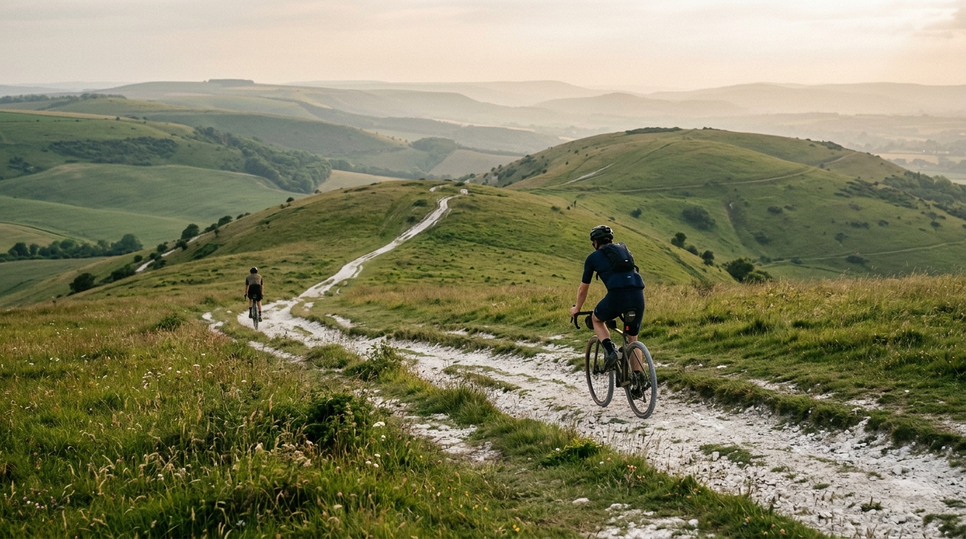
The South Downs Way is a 160 km National Trail that runs from Winchester in Hampshire to Eastbourne on the East Sussex coast, following the chalk ridge of the South Downs. It is open to walkers, horse riders and cyclists, and forms one of the best multi-day gravel rides in the UK.
Terrain
The trail follows the ridge tops, which means relentless short steep climbs and descents - 4150 m of total elevation gain across the route despite never exceeding 270 m above sea level. The surface is mostly chalk and flint farm track, packed dirt, and short sections of singletrack. After heavy rain, the chalk turns to slick gluey mud that can stop you completely.
History
The trail was designated a National Trail in 1972 and traces a route used since the Bronze Age - Iron Age forts and Saxon burial mounds dot the ridge. Cyclists have ridden it as a multi-day adventure since the late 1980s; the SDW Double (a there-and-back-again 320 km attempt) has become a small but growing endurance challenge.
Tips
This is gravel terrain - 38 to 47 mm tyres are ideal. A drop bar gravel bike works for most of the route, but the steeper descents (especially around Steyning Bowl) benefit from a hardtail. Water is sparse on the ridge - plan refuel stops in the valley villages (Buriton, Cocking, Bramber, Lewes). Two-day attempts are common; three-day attempts are more relaxed.
Best time
Late May through September. Avoid prolonged wet spells - the chalk surface becomes unrideable. Weekday rides are quieter; summer weekends see significant walker and horse traffic, which requires patience and courtesy at gates.